High Surf Warning!
“This coastal flooding is the greatest non-tropical cyclone related swell event experienced in the local area since the Perfect storm of 1991.”
– NOAA, 19 MARCH 2008, San Juan PR.
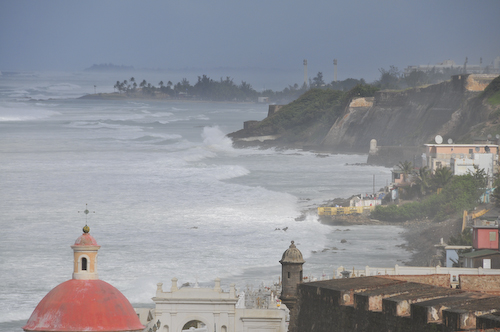
So began the day in Puerto Rico when my daughter and me arrived to enjoy a few days over spring break. We had originally intended to take the ferry to Culebra for a day of sun and fun, but the 30 foot waves at sea caused all ferry service to Culebra and Vieques to suspend for several days.
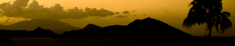
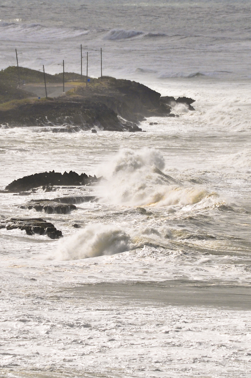
The view above was taken from Old San Juan looking eastward towards Condado and Pinones. Flooding in Pinones was extensive, causing evacuations and road/beach closures. Video footage form the local TV stations captured storm surges of several feet in some areas.
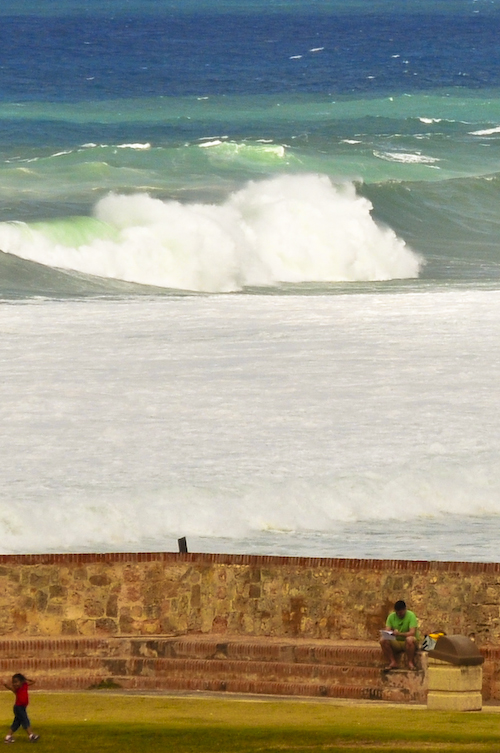
The wind, surf and sea spray were pretty amazing. These waves breaking near El Morro were 20 to 30 feet tall! It was also spring break for school-aged children in Puerto Rico, and the added benefit of high winds made kite flying a necessity.
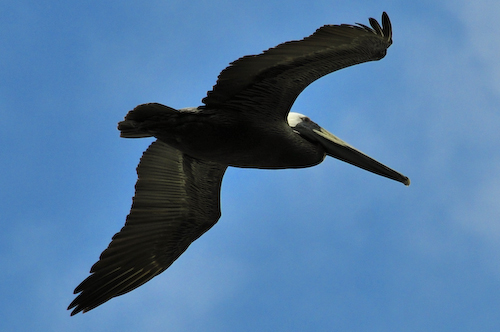
Kites weren’t the only fliers today. Birds of all kinds enjoyed the constant breeze, including this Brown Pelican (Pelecanus occidentalis), which is the smallest of the eight species of pelican, although it is a large bird in nearly every other regard. It is 106-137 cm (42-54 in) in length, weighs from 2.75 to 5.5 kg (6-12 lb) and has a wingspan from 1.83 to 2.5 m (6 to 8.2 ft).
This bird is distinguished from the American White Pelican by its brown body and its habit of diving for fish from the air, as opposed to co-operative fishing from the surface. Groups of Brown Pelicans often travel in single file, flying low over the water’s surface. It eats mainly herring-like fish.
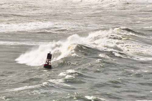
This red buoy, a type of sea mark which identifies the approach to San Juan Harbor, was having a rough go of it. The International Association of Lighthouse Authorities defines two systems of marks specifying the shapes, colors and characteristic lights of buoys, depending on their purpose. For historical reasons, there are two contradictory systems of lateral marks in use:
- IALA System B in the Americas, the Philippines and Japan
- IALA System A everywhere else.
The two systems differ principally in the colors used to denote the two sides of a channel. When approaching a harbor from seaward, System A places conical green marks to starboard and cylindrical red ones to port. In System B these are replaced with conical red marks to starboard and cylindrical green ones to port. This can be remembered (for System B) with the mnemonic “Red, right, return”. Another System B mnemonic, which also helps with buoy numbering is “Even Red Left Port” (as in Eric the Red) – Even Numbered buoys are red, on your left (port) side leaving port. In any case, since in many harbors it is not always apparent which direction is seaward, buoys should be used in connection with the appropriate nautical chart. Additionally, since marks may be off station due to collision with ships, storms or other factors, they should be used with caution and not relied on solely for navigation.
The shattered water made a misty din.
Great waves looked over others coming in,
And thought of doing something to the shore
That water never did to land before.
The clouds were low and hairy in the skies,
Like locks blown forward in the gleam of eyes.
You could not tell, and yet it looked as if
The shore was lucky in being backed by cliff,
The cliff in being backed by continent;
It looked as if a night of dark intent
Was coming, and not only a night, an age.
Someone had better be prepared for rage.
There would be more than ocean-water broken
Before God’s last Put out the light was spoken.
Once By The Ocean
Robert Frost

